History of Road Construction and Highway Planning in India
Table of Contents
INTRODUCTION
History of Road Construction and Highway Planning in India
- Road – Any hard surface on which a vehicle can travel.
- Pavement – If a Road is constructed with a number of layers is called as pavement.
- Highway – pavement is designed for high speed & high traffic.
Highway is constructed over an embankment for No-drainage problem.
R.L of Highway > R.L of High Flood level
Classification of Road
1) Urban Road
Expressway
- It provided for connecting major cities
- In an express highway, extra facilities are provided and limited control access.
- Design for very high speed
Arterial street
- This road within cities for high mobility of traffic with a continuous route.
Sub-Arterial street
- This provided for a lower level of travel mobility than arterial streets.
Collector street
- Constructed for distributing & collecting the traffic.
Local street
- This provided access to residential, commercial, institutional, or business areas.
2) Rural Road
- National highway – connecting commercial & industrial sector with airport, seaport, tourist centre, state capitals.
- Control by CPWD & MES.
- State highway – main road of the state connecting with the national highway or important cities within the state. – control by state agencies (PWD, ZP)
- District Road – connecting the village to the district headquarters, or national highway, or the state highway
- Major District Road
- Other District Road
- Village Road – connecting village to village. Contribution to Transportation
Railway > Roadway > Waterway > Airway
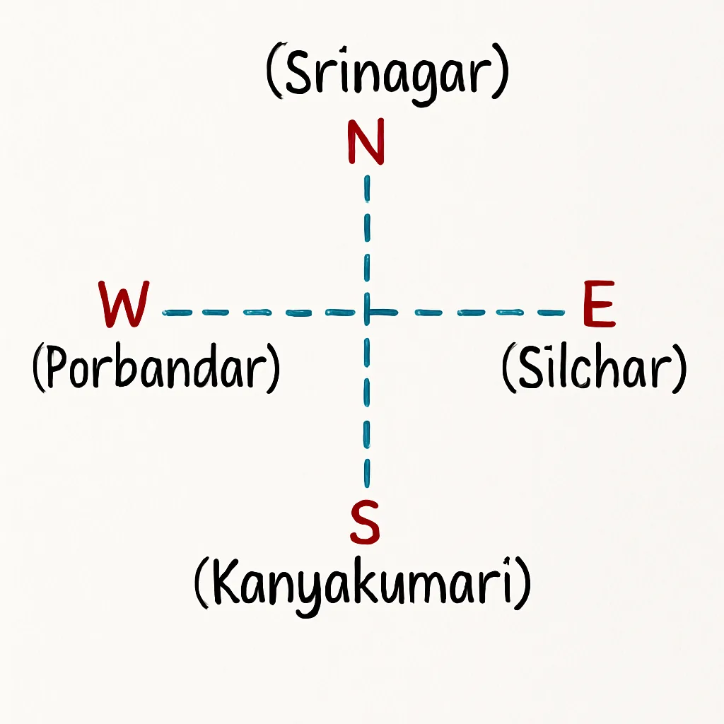
North-south corridor & East-west corridors
DEVELOPMENT AND PLANNING
- Roman Roads
- They are built straight without a gradient.
- The total thickness of these roads is 75 to 120 cm
- Drawbacks –
- No drainage system
- No crosslope provided
- large foundation stones placed at the bottom.
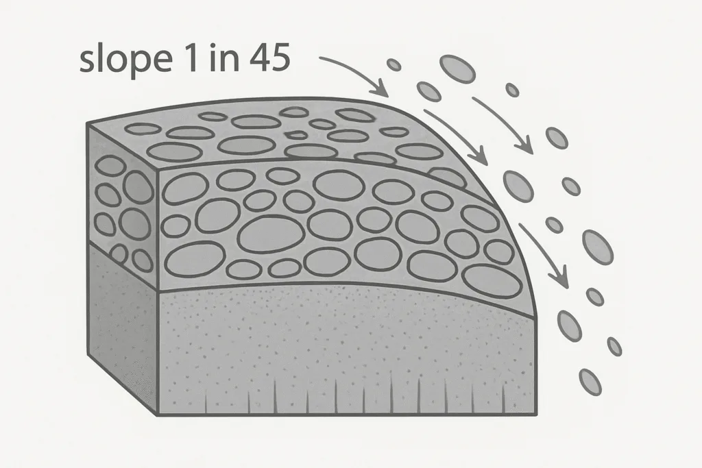
- Tresaguet construction. ⇒ total width = 5.4m
- Only the top course was made with a cross slope of 1 in 45, and side drains were provided at a slope of 1 in 20.
- Drawbacks –
- No cross-slope provided to the drain layer other than the top (non-uniform
distribution of loads) - large foundation stones provided at the bottom (Illustration showing slope 1 in 20, slope 1 in 45, 2.7m)
- No cross-slope provided to the drain layer other than the top (non-uniform
- Only the top course was made with a cross slope of 1 in 45, and side drains were provided at a slope of 1 in 20.

- Telford construction ⇒ total width 9m
- Crossslope is provided to all layers. Therefore No drainage problem.
- Drawbacks
- large foundation stones at the bottom (Illustration showing slope 1 in 45)
- Crossslope is provided to all layers. Therefore No drainage problem.
- Macadam construction ⇒ 9m
convex shape for ease of drainage- The subgrade & top surface were given a crossslope of 1 in 36 to facilitate
Subgrade drainage. - Minimum thk. from edge to centre is 25cm
- He suggests the material for different layers as per the stress developed
in each layer. Therefore, large foundation stones are not required.
- The subgrade & top surface were given a crossslope of 1 in 36 to facilitate
Water Bound Macadam (WBM) Ip < 6%
- It is a dense & compact course.
- Broken stone used as a base course
- Stone dust is used as a binding material.
Disadvantage
- WBM roads are suitable for low-speed traffic such as iron wheel traffic.
- WBM road produces dust in service.
Note ⇒ Now, a days, bitumen bound macadam road is used.
Recommendation by the Jaykar committee [1927]
- Road development should be considered as
- Road development should be considered as a National interest
- Extra tax should be levied on petrol, diesel for Road development [Central Road Fund – 1929]
- A semi-official technical body should be established for technical development.
- IRC -Indian Road Congress – 1934
- Motor Vehicle Act – 1939
- A research organisation should be established to carry out the Research & development work.
- [Central Road Research Institute (CRRI) – 1950]
- preference for long-term planning (20 years)
- Note ⇒
- National highway Act – 1956
- Highway Research board – 1973
| – | 1st 20-year plan Nagpur | 2nd 20-year plan Bombay | 3rd 20-year plan Lucknow |
|---|---|---|---|
| Year | 1943-1963 | 1961-1981 | 1981-2001 |
| Density | \frac{16 \:km}{100 \:km^2} | \frac{32 \:km}{100 \:km^2} | \frac{82 \:km}{100 \:km^2} |
| Road pattern | Star & grid pattern | Star & grid pattern | 32 km/100 km² |
| Development allowance | 15% | 5% | Nil |
| Classification | NH, SH, MDR, ODR, V.R | NH, SH, MDR, ODR, V.R | primary- expressway N.H Secondary- SH and MDR Terfiany- ODR and MR |
| Expressways provision | _ | 1600 Km | 2000Km |
Length calculation as per the 3rd 20-year plan
- Total length of Road = 4.17 × {No. of towns & villages}
or
Road density × Area - Length \:of \:N.H = \frac{Area \:of \:state}{50} ,
- Length \:of \:S.H = \frac{Area \:of \:state }{25}
or
62.4 × No. of towns – (length of NH) - Length \:of \:MDR = \frac{Area \:of \:state }{12.5} ,
- Length of O.D.R. and V.R (Rural Road) = [Total length of-length of (NH+SH+MDR) road]
Here is the text written on the photo:
- Alignment – centre line of highway
- Alignment should be
- short
- safe
- economical (cutting = filling)
- Easy
- Alignment should be
Stages of highway engineering survey
- Map study
- In this stage, topographical maps are used.
- ii) Alignment should avoid river, valley, pond lake.
- Reconnaissance survey
- It is done by visiting at site location.
- Collect general characteristics of an area with a simple instrument.
(traffic survey, nature of soil, material survey) - Decide on the alternative routes.
- Preliminary survey
- Collects physical characteristics and details of topography.
- “The soil survey can be carried out. Roughly cut depth 1 to 3m”
- Compare the different proposals using diff. methods.
- Detailed survey
- The main objective is to be carried out the detailed survey along route.
- The final selected route is put on paper & details are worked out.
- Final survey
- DPR (Detailed project report) is prepared.
- Design, plan, material estimation, cost estimation, specification, bridge site, etc.
History of Road Construction and Highway Planning in India
Rail Joints in Railways: Types, Applications, and Importance:- https://engineerlatest.com/rail-joints-in-railways-types-applications-and-importance/


2 comments